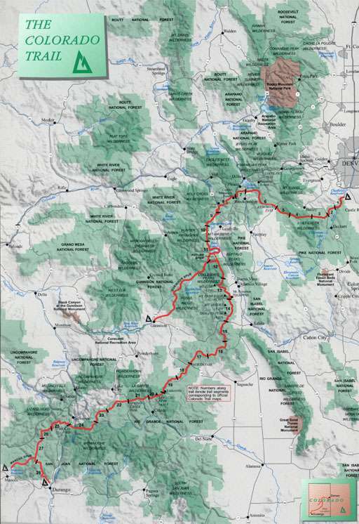
The Segments of the Colorado Trail
| Segment No. and Trailheads | Distance | Elevation Gain |
| 1. Waterton Canyon to South Platte Townsite | 16.1 | 2,224 |
| 2. South Platte Townsite to County Road 126 | 9.4 | 1,958 |
| 3. County Road 126 to Forest Service Road 543 | 13.4 | 1,450 |
| 4. Forest Service Road 543 to Long Gulch | 17.2 | 2,880 |
| 5. Long Gulch to Kenosha Pass | 14.0 | 1,520 |
| 6. Kenosha Pass to Gold Hill Trailhead | 30.4 | 2,560 |
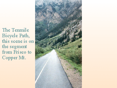
| 7. Gold Hill Trailhead to Copper Mountain | 13.1 | 3,680 |
| 8. Copper Mountain to Tennessee Pass | 24.1 | 3,660 |
| 9. Tennessee Pass to Hagerman Pass Road | 14.9 | 1,160 |
| 10. Hagerman Pass Road to Halfmoon Creek | 11.4 | 1,760 |
| 11. Halfmoon Creek to Clear Creek Road | 28.9 | 4,200 |
| 12. Clear Creek Road to N. Cottonwood Creek Rd | 18.2 | 4,520 |
| 13. N. Cottonwood Creek to Chalk Creek Road | 22.2 | 3,700 |
| 14. Chalk Creek Road to U.S. Highway 50 | 20.0 | 3,100 |
| 15. U.S. Highway 50 to Marshall Pass | 14.0 | 3,340 |
| 16. Marshall Pass to Sargents Mesa | 14.5 | 2,840 |
| 17. Sargents Mesa to Colorado Highway 114 | 20.3 | 2,440 |
| 18. Colorado Highway 114 to Saguache Park Rd | 12.9 | 1,660 |
| 19. Saguache Park Road to Eddiesville Trailhead | 13.5 | 1,660 |
| 20. Eddiesville Trailhead to San Luis Pass | 12.2 | 2,680 |
| 21. San Luis Pass to Spring Creek Pass | 14.5 | 2,920 |
| 22. Spring Creek Pass to Carson Saddle | 18.3 | 3,980 |
| 23. Carson Saddle to Rio Grande Reservoir Road | 12.0 | 1,020 |
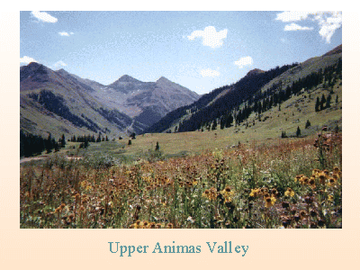
| 24. Rio Grande Reservoir Road to Molas Pass | 21.1 | 4,600 |
| 25. Molas Pass to Bolam Pass Road | 19.9 | 2,720 |
| 26. Bolam Pass Road to Hotel Draw Road | 11.0 | 1,320 |
| 27. Hotel Draw Road to Cumberland Basin | 20.1 | 3,440 |
| 28. Cumberland Basin to Junction Creek Trailhead | 20.8 | 1,160 |
| The Trail Total | 491 | 74,152 |